Interact with Map Layers
Map Layers Tool

The Map Layers Tool opens the layer list (Table of Contents) to show the data available in the map.
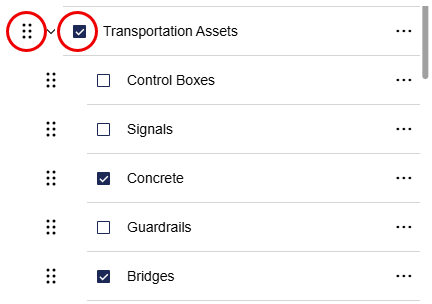
The check box next to the Group Title (e.g.Transportation Assets) OR Layer turns the layers on or off in the map.
6 Dots – click the dots and hold to move data up or down in the layer list (changes the order they draw in the map).
The data layers greyed out are not available at the current scale (e.g. Recycling and Services).

The side arrow (>) next to the check box expands or collapses the individual layers inside the group.
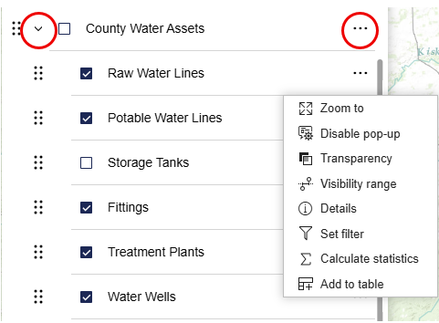
Ellipsis (3 dots) on single layer
- Zoom to – zooms the map to a scale and position the data is visible in the map
- Details – opens metadata in a new window
- Set filter – determine data shown using data attributes
- Calculate Statistics - calculates statistics such as Sum, Minimum, Maximum, Average for the selected layer
- Add to table – adds the data attributes to the attribute table